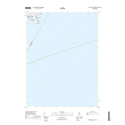
2018 Map of Narragansett Pier OE S
USGS Topo · Published 2018About this map
Point Judith anchors the northwestern corner of this coastal survey, where the rocky Rhode Island shoreline meets the Atlantic Ocean. The map documents the recreational and maritime landscape of the South County coast, featuring the popular sands of Captain Roger W Wheeler State Beach and the smaller enclave at Seaweed Beach. Beyond the immediate surf, the survey traces the boundary between Washington and Newport counties as it extends into open water, following the path of the Intracoastal Waterway. This area is characterized by low-lying coastal features like Muddy Pond and hazardous outcrops such as Peaked Rock and Champlin Rock, which have historically defined the navigation of these waters. The limited residential grid is represented by streets like Chestnut Ave and Calif Ave, illustrating the intersection of local beach communities with the vast marine environment.
Find a feature on this map
11 named features on this map. Tap any name to fly to it.
Don’t see what you’re looking for? This feature index may not catch every label — zoom into the map to look around manually.
Map Details
Editions of this 2018 Narragansett Pier OE S Map
This is the sole edition of this map. No revisions or reprints were ever made.
Other maps of this area

1889 · Charlestown
USGS Topo · 1:62,500

1889 · Newport
USGS Topo · 1:62,500

1889 · Block Island
USGS Topo · 1:62,500

1894 · Block Island
USGS Topo · 1:62,500

1894 · Newport
USGS Topo · 1:62,500

1899 · Block Island
USGS Topo · 1:62,500

1904 · Newport
USGS Topo · 1:62,500

1919 · Charlestown
USGS Topo · 1:62,500
1920 · Newport
USGS Topo · 1:62,500

1921 · Charlestown
USGS Topo · 1:62,500