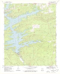
1969 Map of Narrows Dam
USGS Topo · Published 1977About this map
Lake Greeson dominates this landscape in the late 1960s, formed by the engineering of the Narrows Dam along the Little Missouri River. The map documents a transition from traditional river valley life to a recreation-centered economy, evidenced by numerous public use areas like Pikeville and Kirby Landing. While the reservoir altered the terrain, older rural foundations remain visible through the Midway Church and scattered family burial grounds such as Hicks Cemetery and Cummings Cemetery.
Find a feature on this map
76 named features on this map. Tap any name to fly to it.
Don’t see what you’re looking for? This feature index may not catch every label — zoom into the map to look around manually.
Map Details
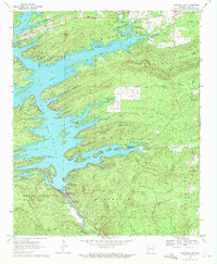
Editions of this 1969 Narrows Dam Map
2 editions found
Other maps of this area

1906 · Caddo Gap
USGS Topo · 1:125,000

1936 · Athens
USGS Topo · 1:48,000

1936 · Glenwood
USGS Topo · 1:48,000

1942 · Glenwood
USGS Topo · 1:62,500

1942 · Athens
USGS Topo · 1:62,500

1949 · Glenwood
USGS Topo · 1:62,500

1955 · Little Rock
USGS Topo · 1:250,000

1956 · Little Rock
USGS Topo · 1:250,000

1960 · Little Rock
USGS Topo · 1:250,000

1964 · Little Rock
USGS Topo · 1:250,000