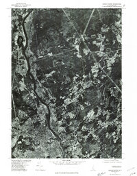
1977 Map of Nashua North
USGS Topo · Published 1981About this map
The confluence of the Nashua River and the Merrimack River serves as the focal point for this 1977 orthophotoquad, which captures the urban and suburban development of southern New Hampshire during the late 1970s. The aerial imagery highlights the dense street grid of Nashua and the neighboring community of Hudson, contrasted against the more wooded landscapes to the north.
Find a feature on this map
8 named features on this map. Tap any name to fly to it.
Don’t see what you’re looking for? This feature index may not catch every label — zoom into the map to look around manually.
Map Details
Editions of this 1977 Nashua North Map
This is the sole edition of this map. No revisions or reprints were ever made.
Other maps of this area

1886 · Lowell
USGS Topo · 1:62,500

1893 · Lowell
USGS Topo · 1:62,500

1893 · Groton
USGS Topo · 1:62,500

1905 · Manchester
USGS Topo · 1:62,500

1906 · Milford
USGS Topo · 1:62,500

1918 · Lowell
USGS Topo · 1:62,500

1921 · Lowell
USGS Topo · 1:62,500

1931 · Lowell
USGS Topo · 1:48,000

1931 · Groton
USGS Topo · 1:48,000

1935 · Groton
USGS Topo · 1:62,500