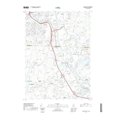
2018 Map of Nashua South
USGS Topo · Published 2018About this map
The Merrimack River winds through this interstate borderlands region, serving as the central geographic feature between Nashua and Lowell. This landscape is defined by its transition from suburban centers to the rolling upland topography of hills like Gilboa Hill, Spectacle Hill, and Forest Hill. The area around Tyngsboro and Dunstable maintains a character defined by scattered residential corners and numerous small water bodies, including Flint Pond and Muscuppic Lake. Local history is anchored by several burial grounds such as Evergreen Cem and Old Dunstable Cem, alongside institutional landmarks like Rivier Univ and the New Hampshire Institute for Therapeutic Arts. The river remains a focal point for recreation and local industry, marked by Wicassic Falls and the significant landform of Tyngs Island. Cultural sites such as Camp Kiwanis and Camp Massapoag reflect the region's longstanding role as a retreat from the neighboring industrial hubs.
Find a feature on this map
326 named features on this map. Tap any name to fly to it.
Don’t see what you’re looking for? This feature index may not catch every label — zoom into the map to look around manually.
Map Details
Editions of this 2018 Nashua South Map
This is the sole edition of this map. No revisions or reprints were ever made.
Other maps of this area

1886 · Lowell
USGS Topo · 1:62,500

1893 · Lowell
USGS Topo · 1:62,500

1893 · Groton
USGS Topo · 1:62,500

1905 · Manchester
USGS Topo · 1:62,500

1906 · Milford
USGS Topo · 1:62,500

1918 · Lowell
USGS Topo · 1:62,500

1921 · Lowell
USGS Topo · 1:62,500

1931 · Lowell
USGS Topo · 1:48,000

1931 · Groton
USGS Topo · 1:48,000

1935 · Ayer
USGS Topo · 1:24,000