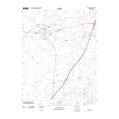
2010 Map of Nashville
USGS Topo · Published 2010About this map
Nashville serves as the focal point of this 2010 Nash County landscape, where modern residential developments like Westgate Terrace and Birchwood Homes meet established landmarks such as Forest Hill Cemetery and Oakland Cemetery. The terrain is defined by a dense network of tributaries, including Stony Creek and Sapony Creek, which flow toward the Tar River in the southeast. Historical road patterns are evident at rural junctions like Snells Crossroads and Cockrells Crossroads, while water management is highlighted by several structures including Bones Pond Dam and the Tar River Dam. The area around Southside Park and Sun Valley illustrates the suburban expansion outward from the town center during the early 21st century. Smaller named communities such as Winwood, Westry, and Sandy Cross are situated along the primary transit corridors that connect these agrarian and residential spaces.
Find a feature on this map
84 named features on this map. Tap any name to fly to it.
Don’t see what you’re looking for? This feature index may not catch every label — zoom into the map to look around manually.
Map Details
Editions of this 2010 Nashville Map
This is the sole edition of this map. No revisions or reprints were ever made.
Other maps of this area

1902 · Rocky Mount
USGS Topo · 1:62,500

1902 · Spring Hope
USGS Topo · 1:62,500

1904 · Rocky Mount
USGS Topo · 1:62,500

1904 · Springhope
USGS Topo · 1:62,500

1953 · Norfolk
USGS Topo · 1:250,000

1953 · Rocky Mount
USGS Topo · 1:250,000

1953 · Raleigh
USGS Topo · 1:250,000

1953 · Greensboro
USGS Topo · 1:250,000

1954 · Greensboro
USGS Topo · 1:250,000

1954 · Rocky Mount
USGS Topo · 1:250,000