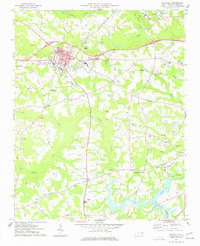
1977 Map of Nashville
USGS Topo · Published 1977About this map
Nashville serves as the hub of this Nash County landscape, where the Seaboard Coast Line railroad cuts through the center of town near the Courthouse and City Hall. The map reveals a community defined by its educational and religious institutions, featuring numerous schools like Nash Sch and Nash Central HS, alongside a dense network of rural churches such as Union Hill Ch, Ebenezer Ch, and St Paul Ch.
Find a feature on this map
52 named features on this map. Tap any name to fly to it.
Don’t see what you’re looking for? This feature index may not catch every label — zoom into the map to look around manually.
Map Details
Editions of this 1977 Nashville Map
This is the sole edition of this map. No revisions or reprints were ever made.
Other maps of this area

1902 · Rocky Mount
USGS Topo · 1:62,500

1902 · Spring Hope
USGS Topo · 1:62,500

1904 · Rocky Mount
USGS Topo · 1:62,500

1904 · Springhope
USGS Topo · 1:62,500

1953 · Norfolk
USGS Topo · 1:250,000

1953 · Rocky Mount
USGS Topo · 1:250,000

1953 · Raleigh
USGS Topo · 1:250,000

1953 · Greensboro
USGS Topo · 1:250,000

1954 · Greensboro
USGS Topo · 1:250,000

1954 · Rocky Mount
USGS Topo · 1:250,000