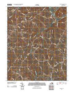
2010 Map of Nathalie
USGS Topo · Published 2010About this map
Clarkton and Nathalie anchor this rural Halifax County landscape where the Roanoke River and Catawba Creek have shaped centuries of settlement. The map reveals a high concentration of local family history and community markers, including Saint Thomas Cemetery and Childrey Cemetery. Evidence of early agricultural industry is visible at Morefield Mill on the upper reaches of Catawba Creek, while the presence of Hughes Dam and Railroad Drive indicates how water power and rail transit once served these rural outposts. Small communities like Lennig, Catawba, and Whitesville are connected by a network of winding local roads such as Coles Ferry Road and Hunting Creek Road, reflecting the traditional tobacco-growing heritage of the Virginia Piedmont.
Find a feature on this map
64 named features on this map. Tap any name to fly to it.
Don’t see what you’re looking for? This feature index may not catch every label — zoom into the map to look around manually.
Map Details
Editions of this 2010 Nathalie Map
This is the sole edition of this map. No revisions or reprints were ever made.
Other maps of this area

1892 · Lynchburg
USGS Topo · 1:125,000

1892 · Appomattox
USGS Topo · 1:125,000

1947 · Roanoke
USGS Topo · 1:250,000

1953 · Greensboro
USGS Topo · 1:250,000

1954 · Greensboro
USGS Topo · 1:250,000

1954 · Halifax
USGS Topo · 1:62,500

1954 · Riceville
USGS Topo · 1:62,500

1956 · Brookneal
USGS Topo · 1:62,500

1956 · Gladys
USGS Topo · 1:62,500

1959 · Roanoke
USGS Topo · 1:250,000