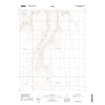
2018 Map of National Canyon SW
USGS Topo · Published 2018About this map
National Canyon and Mohawk Canyon dominate this high-desert landscape in Coconino County, where the relief is defined by deep drainages cutting through the plateau. The survey captures the intricate drainage network of Mohawk Cr in the northwest and the winding path of Sandstone Wash to the southeast. Human infrastructure is nearly absent from this area, represented primarily by Co RD 12, which traverses the eastern flats of the quadrangle. This 2018 edition provides a precise look at the township and range boundaries, including t31n r6w and t30n r7w, highlighting the vast, uninhabited stretches of Arizona's canyon country before any modern development or major roadway expansions altered the terrain.
Find a feature on this map
11 named features on this map. Tap any name to fly to it.
Don’t see what you’re looking for? This feature index may not catch every label — zoom into the map to look around manually.
Map Details
Editions of this 2018 National Canyon SW Map
This is the sole edition of this map. No revisions or reprints were ever made.
Other maps of this area

1886 · Diamond Creek
USGS Topo · 1:250,000

1886 · Mt. Trumbull
USGS Topo · 1:250,000

1886 · Chino
USGS Topo · 1:250,000

1886 · Kaibab
USGS Topo · 1:250,000

1891 · Chino
USGS Topo · 1:250,000

1892 · Diamond Creek
USGS Topo · 1:250,000

1892 · Mt. Trumbull
USGS Topo · 1:250,000

1948 · Williams
USGS Topo · 1:250,000

1953 · Grand Canyon
USGS Topo · 1:250,000

1954 · Williams
USGS Topo · 1:250,000