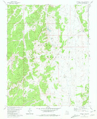
1981 Map of National Tank
USGS Topo · Published 1981About this map
Hualapai Indian Reservation lands dominate this high-plateau landscape, where drainage patterns and water collection points dictate the geography of the high desert. The map illustrates a complex network of dry washes, most notably Sandstone Wash and Albers Wash, which carve through the terrain toward the deep incisions of National Canyon. Human presence is marked by essential water-management features like National Tank, Sink Tank, and Potters Hole, which were vital for supporting life and livestock in this arid environment. The inclusion of the Hualapai Indian Reservation Boundary and several Borrow Pits provides insight into land use and infrastructure development during the early 1980s, reflecting a period of precise photogrammetric mapping by the Geological Survey.
Find a feature on this map
10 named features on this map. Tap any name to fly to it.
Don’t see what you’re looking for? This feature index may not catch every label — zoom into the map to look around manually.
Map Details
Editions of this 1981 National Tank Map
This is the sole edition of this map. No revisions or reprints were ever made.
Other maps of this area

1886 · Diamond Creek
USGS Topo · 1:250,000

1886 · Mt. Trumbull
USGS Topo · 1:250,000

1886 · Chino
USGS Topo · 1:250,000

1886 · Kaibab
USGS Topo · 1:250,000

1891 · Chino
USGS Topo · 1:250,000

1892 · Diamond Creek
USGS Topo · 1:250,000

1892 · Mt. Trumbull
USGS Topo · 1:250,000

1948 · Williams
USGS Topo · 1:250,000

1953 · Grand Canyon
USGS Topo · 1:250,000

1954 · Williams
USGS Topo · 1:250,000