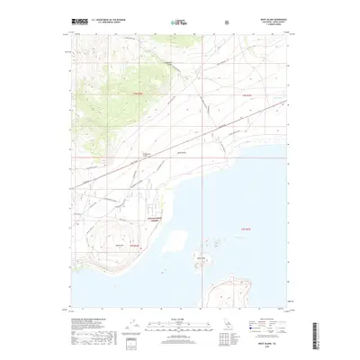
2018 Map of Negit Island
USGS Topo · Published 2018About this map
Negit Island and the stark northern shoreline of Mono Lake dominate this high-desert landscape in the eastern Sierra. The map details a complex network of historic land use, from the Dechambeau Ranch Q-005 to the thermal features at Dechambeau Hot Springs. Infrastructure through the Mono Valley reflects a reliance on local resources and transport, including the Dechambeau R. Pipeline and thoroughfares like Pole Line Rd and Waford Springs Cutoff.
Find a feature on this map
28 named features on this map. Tap any name to fly to it.
Don’t see what you’re looking for? This feature index may not catch every label — zoom into the map to look around manually.
Map Details
Editions of this 2018 Negit Island Map
This is the sole edition of this map. No revisions or reprints were ever made.
Other maps of this area

1901 · Mt. Lyell
USGS Topo · 1:125,000

1909 · Hawthorne
USGS Topo · 1:250,000

1909 · Bridgeport
USGS Topo · 1:125,000

1911 · Bridgeport
USGS Topo · 1:125,000

1911 · Hawthorne
USGS Topo · 1:250,000

1914 · Mt. Morrison
USGS Topo · 1:125,000

1915 · Hawthorne
USGS Topo · 1:250,000

1920 · Bridgeport
USGS Topo · 1:125,000

1947 · Mariposa
USGS Topo · 1:250,000

1948 · Walker Lake
USGS Topo · 1:250,000