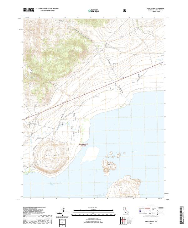
2021 Map of Negit Island
USGS Topo · Published 2021About this map
Negit Island and Paoha Island emerge from the saline expanse of Mono Lake in this 2021 study, revealing a volcanic landscape defined by craters and desert springs. Along the northern shoreline, the geography is marked by Black Point Hill and the dark volcanic sands of Black Point. The area's ranching history is evidenced by the Dechambeau Ranch Q. 005 and the nearby Dechambeau Hot Springs, situated just south of the Mono Valley.
Find a feature on this map
29 named features on this map. Tap any name to fly to it.
Don’t see what you’re looking for? This feature index may not catch every label — zoom into the map to look around manually.
Map Details
Editions of this 2021 Negit Island Map
This is the sole edition of this map. No revisions or reprints were ever made.
Other maps of this area

1901 · Mt. Lyell
USGS Topo · 1:125,000

1909 · Hawthorne
USGS Topo · 1:250,000

1909 · Bridgeport
USGS Topo · 1:125,000

1911 · Bridgeport
USGS Topo · 1:125,000

1911 · Hawthorne
USGS Topo · 1:250,000

1914 · Mt. Morrison
USGS Topo · 1:125,000

1915 · Hawthorne
USGS Topo · 1:250,000

1920 · Bridgeport
USGS Topo · 1:125,000

1947 · Mariposa
USGS Topo · 1:250,000

1948 · Walker Lake
USGS Topo · 1:250,000