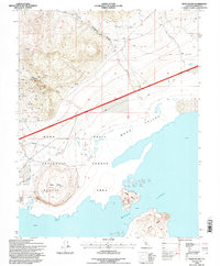
1994 Map of Negit Island
USGS Topo · Published 1997About this map
Mono Lake and its distinctive volcanic features dominate this mid-1990s landscape within the Mono Basin. The map highlights the significant landforms of Negit Island and Paoha Island rising from the water, alongside the dark, rounded volcanic cinder cone of Black Point on the northern shore. This environment is defined by its transition from the high desert floor to the steep drainages of Bridgeport Canyon and Rancheria Gulch.
Find a feature on this map
23 named features on this map. Tap any name to fly to it.
Don’t see what you’re looking for? This feature index may not catch every label — zoom into the map to look around manually.
Map Details
Editions of this 1994 Negit Island Map
This is the sole edition of this map. No revisions or reprints were ever made.
Other maps of this area

1901 · Mt. Lyell
USGS Topo · 1:125,000

1909 · Hawthorne
USGS Topo · 1:250,000

1909 · Bridgeport
USGS Topo · 1:125,000

1911 · Bridgeport
USGS Topo · 1:125,000

1911 · Hawthorne
USGS Topo · 1:250,000

1914 · Mt. Morrison
USGS Topo · 1:125,000

1915 · Hawthorne
USGS Topo · 1:250,000

1920 · Bridgeport
USGS Topo · 1:125,000

1947 · Mariposa
USGS Topo · 1:250,000

1948 · Walker Lake
USGS Topo · 1:250,000