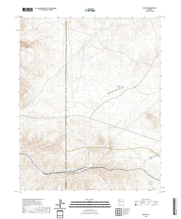
2021 Map of Nelson
USGS Topo · Published 2021About this map
Nelson sits at the confluence of several significant geographical boundaries where Mohave, Coconino, and Yavapai counties meet. This 2021 topographic record of the Arizona high desert illustrates a landscape defined by drainage patterns and aviation infrastructure. Water management is central to the area's utility, marked by features such as Bull Pasture Tank and Limestone Tank, which serve this arid environment. The terrain is deeply incised by Nelson Canyon and Faught Canyon, both of which feed into the broader Truxton Wash system. Transportation in this corner of the state relies on a network of unpaved corridors like Nelson Rd and Indian Rte 19, while the presence of both the Hualapai Airport and the Grand Canyon Caverns Airport highlights the region's role as a waypoint for travelers and local transit.
Find a feature on this map
18 named features on this map. Tap any name to fly to it.
Don’t see what you’re looking for? This feature index may not catch every label — zoom into the map to look around manually.
Map Details
Editions of this 2021 Nelson Map
This is the sole edition of this map. No revisions or reprints were ever made.
Other maps of this area

1886 · Diamond Creek
USGS Topo · 1:250,000

1892 · Diamond Creek
USGS Topo · 1:250,000

1948 · Williams
USGS Topo · 1:250,000

1954 · Williams
USGS Topo · 1:250,000

1956 · Williams
USGS Topo · 1:250,000

1960 · Williams
USGS Topo · 1:250,000

1961 · Williams
USGS Topo · 1:250,000

1967 · Peach Springs
USGS Topo · 1:24,000
1967 · Peach Springs Canyon
USGS Topo · 1:24,000
1967 · Peach Springs NE
USGS Topo · 1:24,000