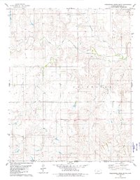
1979 Map of Nescatunga Creek South
USGS Topo · Published 1980About this map
The Old Indian Treaty Boundary cuts horizontally across this landscape, marking a historical division just south of the Salt Fork Arkansas River. This 1970s survey captures a sparse prairie environment defined by seasonal drainage systems and the emerging energy footprint indicated by Oil Wells in the north and southeast. The terrain transitions from the broader river valley into the broken ground of Cristy Canyon and the surrounding township ranges of Avilla and Coldwater. The intricate drainage network includes Nescatunga Creek and Mustang Creek, which feed into the primary river system. This map is a record of the Kansas-Oklahoma borderlands before modern agricultural and industrial expansion further altered the character of these high plains.
Find a feature on this map
13 named features on this map. Tap any name to fly to it.
Don’t see what you’re looking for? This feature index may not catch every label — zoom into the map to look around manually.
Map Details
Editions of this 1979 Nescatunga Creek South Map
This is the sole edition of this map. No revisions or reprints were ever made.
Other maps of this area

1892 · Coldwater
USGS Topo · 1:125,000

1955 · Woodward
USGS Topo · 1:250,000

1955 · Pratt
USGS Topo · 1:250,000

1958 · Woodward
USGS Topo · 1:250,000

1959 · Pratt
USGS Topo · 1:250,000

1970 · Lookout
USGS Topo · 1:24,000

1970 · Freedom NE
USGS Topo · 1:24,000

1970 · Freedom NW
USGS Topo · 1:24,000

1979 · Protection NE
USGS Topo · 1:24,000
1980 · Nescatunga Creek North
USGS Topo · 1:24,000