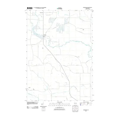
2010 Map of Neshkoro
USGS Topo · Published 2010About this map
Neshkoro sits as the central hub of this Marquette County landscape, defined by the impoundment of the White River at the Neshkoro Dam. This engineering creates the Neshkoro Millpond 120, a significant water feature that dominates the western portion of the village. The surrounding countryside is a network of waterways and small settlements, including Bannerman to the north and Pine Bluff to the east.
Find a feature on this map
56 named features on this map. Tap any name to fly to it.
Don’t see what you’re looking for? This feature index may not catch every label — zoom into the map to look around manually.
Map Details
Editions of this 2010 Neshkoro Map
This is the sole edition of this map. No revisions or reprints were ever made.
Other maps of this area

1915 · Neshkoro
USGS Topo · 1:48,000

1918 · Neshkoro
USGS Topo · 1:62,500

1955 · Green Bay
USGS Topo · 1:250,000

1957 · Madison
USGS Topo · 1:250,000

1959 · Wautoma
USGS Topo · 1:48,000

1960 · Madison
USGS Topo · 1:250,000

1961 · Redgranite
USGS Topo · 1:62,500

1961 · Montello
USGS Topo · 1:62,500
1961 · Redgranite
USGS Topo · 1:24,000

1961 · Spring Lake
USGS Topo · 1:24,000