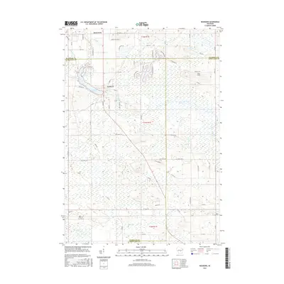
2016 Map of Neshkoro
USGS Topo · Published 2016About this map
Neshkoro sits at the center of this 2016 survey, where the White River is captured by the Neshkoro Mill Pond. The landscape is defined by the intersection of three Wisconsin counties—Marquette, Waushara, and Green Lake—creating a complex jurisdictional boundary. The hydrology of the region is notably intricate, with multiple tributaries including Lunch Cr, Little Lunch Cr, and Sucker Cr feeding toward the larger river systems. To the north, the small settlement of Bannerman is located near the county line, while the southern portion of the quadrangle is drained by the Mecan River. Local history and genealogy are well-represented by several burial grounds, specifically Saint Peter Cem, Germania Cem, and Black Creek Cem, which are situated near the road networks of Co Hwy N and Co Hwy E.
Find a feature on this map
68 named features on this map. Tap any name to fly to it.
Don’t see what you’re looking for? This feature index may not catch every label — zoom into the map to look around manually.
Map Details
Editions of this 2016 Neshkoro Map
This is the sole edition of this map. No revisions or reprints were ever made.
Other maps of this area

1915 · Neshkoro
USGS Topo · 1:48,000

1918 · Neshkoro
USGS Topo · 1:62,500

1955 · Green Bay
USGS Topo · 1:250,000

1957 · Madison
USGS Topo · 1:250,000

1959 · Wautoma
USGS Topo · 1:48,000

1960 · Madison
USGS Topo · 1:250,000

1961 · Redgranite
USGS Topo · 1:62,500

1961 · Montello
USGS Topo · 1:62,500
1961 · Redgranite
USGS Topo · 1:24,000

1961 · Spring Lake
USGS Topo · 1:24,000