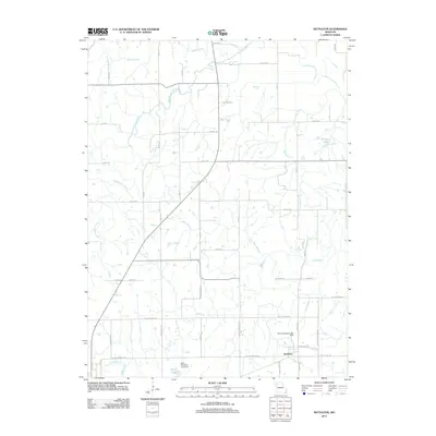
2012 Map of Nettleton
USGS Topo · Published 2012About this map
Nettleton serves as the primary focal point of this agricultural landscape in northwestern Missouri, situated among a dense network of tributaries that feed into the Shoal Creek watershed. The terrain is defined by the winding paths of Marrowbone Creek and Honey Creek in the north, while the southern reaches are marked by Lick Fork and Long Branch. This 2012 survey illustrates a mature rural infrastructure where section-line roads like NE Mulberry Rd and Waltz Ave provide access to dispersed farmsteads and localized water management features. Notable for local history and land-use studies are the Byron Simpson Lake Dam and John Simpson Lake Dam, which signify private or small-scale water impoundments such as Penny Lake. The map details the transition from traditional highway routes like NE Old Hwy 36 to the more modern grid that supports the region's ranching and farming operations.
Find a feature on this map
50 named features on this map. Tap any name to fly to it.
Don’t see what you’re looking for? This feature index may not catch every label — zoom into the map to look around manually.
Map Details
Editions of this 2012 Nettleton Map
This is the sole edition of this map. No revisions or reprints were ever made.
Other maps of this area

1922 · Gallatin
USGS Topo · 1:62,500

1924 · Polo
USGS Topo · 1:62,500

1924 · Braymer
USGS Topo · 1:62,500

1924 · Winston
USGS Topo · 1:62,500

1950 · Kansas City
USGS Topo · 1:250,000

1953 · Moberly
USGS Topo · 1:250,000

1954 · Kansas City
USGS Topo · 1:250,000

1954 · Moberly
USGS Topo · 1:250,000

1956 · Kansas City
USGS Topo · 1:250,000

1957 · Moberly
USGS Topo · 1:250,000