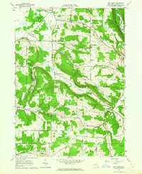
1963 Map of New Albion
USGS Topo · Published 1964About this map
Conewango Swamp and its associated waterways dominate the western edge of this territory, where the North Branch Conewango Creek begins its journey through the lowlands of Leon and Dayton. The settlement pattern in the early 1960s reveals a landscape defined by small crossroads hamlets such as Wesley, East Leon, and Judd Corners, each linked by a network of hollow roads following the local topography. The Erie-Lackawanna RR cuts through the northeastern corner, skirting the South Branch Cattaraugus Creek near Persia. Genealogists will find several burial sites including the Tug Hill Cem and Lower New Albion Cem, which anchor the small community of New Albion. The map captures a moment of transition where traditional upland farming is reflected in family-named features like Ruckhs Hill and Snyder Hill, juxtaposed with the natural expanses of Waterman Swamp.
Find a feature on this map
41 named features on this map. Tap any name to fly to it.
Don’t see what you’re looking for? This feature index may not catch every label — zoom into the map to look around manually.
Map Details
Editions of this 1963 New Albion Map
2 editions found
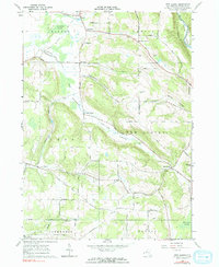
Other maps of this area

1900 · Cherry Creek
USGS Topo · 1:62,500

1905 · Jamestown
USGS Topo · 1:62,500

1922 · Randolph
USGS Topo · 1:62,500

1923 · Randolph
USGS Topo · 1:62,500

1923 · Cattaraugus
USGS Topo · 1:62,500

1938 · Cattaraugus
USGS Topo · 1:62,500

1941 · Cattaraugus
USGS Topo · 1:62,500

1941 · Cherry Creek
USGS Topo · 1:62,500

1942 · Jamestown
USGS Topo · 1:62,500

1943 · Randolph
USGS Topo · 1:62,500