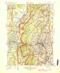
1946 Map of New Britain
USGS Topo · Published 1946About this map
New Britain serves as the dense urban core of this mid-century survey, surrounded by the dramatic ridgelines of Talcott Mountain, Rattlesnake Mtn, and Bradley Mtn. The landscape is a complex mix of industrial-era infrastructure and institutional landmarks, including the State Teachers College and the Polish Orphanage St Lucien Home. Transportation networks are heavily defined by the New York New Haven and Hartford railroad and the College Highway, while the hydraulic needs of the growing city are met by significant works like the Shuttle Meadow Reservoir and Plainville Reservoir. Smaller settlements such as Kensington and Plainville punctuate the valleys, connected by a grid of streets including Shuttle Meadow Ave and Corbin Ave. Significant green spaces like Stanley Quarter Park and the rugged passage at Cooks Gap highlight the tension between the expanding urban footprint and the area's prominent geological features.
Find a feature on this map
88 named features on this map. Tap any name to fly to it.
Don’t see what you’re looking for? This feature index may not catch every label — zoom into the map to look around manually.
Map Details
Editions of this 1946 New Britain Map
2 editions found
Other maps of this area

1892 · Hartford
USGS Topo · 1:62,500

1892 · Meriden
USGS Topo · 1:62,500

1892 · Granby
USGS Topo · 1:62,500

1893 · Middletown
USGS Topo · 1:62,500

1893 · Meriden
USGS Topo · 1:62,500

1906 · Farmington
USGS Topo · 1:125,000

1928 · Cromwell
USGS Topo · 1:24,000

1928 · Windsor
USGS Topo · 1:24,000

1944 · Hartford South
USGS Topo · 1:31,680

1945 · Hartford North
USGS Topo · 1:31,680