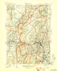
1946 Map of New Britain
USGS Topo · Published 1946About this map
New Britain serves as the industrial and educational anchor of this mid-century Hartford County landscape, where the dense city grid meets the prominent ridge of Talcott Mountain. The map illustrates a period of significant institutional growth, featuring the State Teachers College and specialized facilities like the Polish Orphanage St Lucien Home and the Klingberg Childrens Home. Beyond the urban core, the terrain is defined by the Farmington River corridor and extensive wetlands such as Shade Swamp and Dead Wood Swamp. Infrastructure of the era is clearly marked, from the Sewage Disposal plants to the complex rail network including the Farmington Sta and lines of the New York New Haven and Hartford. This survey provides a precise look at the community's water management system, showing Shuttle Meadow Reservoir and Hartford Reservoir No 1 alongside recreational spaces like the Shuttle Meadow Golf Club.
Find a feature on this map
77 named features on this map. Tap any name to fly to it.
Don’t see what you’re looking for? This feature index may not catch every label — zoom into the map to look around manually.
Map Details
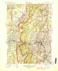
Editions of this 1946 New Britain Map
2 editions found
Other maps of this area

1892 · Hartford
USGS Topo · 1:62,500

1892 · Meriden
USGS Topo · 1:62,500

1892 · Granby
USGS Topo · 1:62,500

1893 · Middletown
USGS Topo · 1:62,500

1893 · Meriden
USGS Topo · 1:62,500

1906 · Farmington
USGS Topo · 1:125,000

1928 · Cromwell
USGS Topo · 1:24,000

1928 · Windsor
USGS Topo · 1:24,000

1944 · Hartford South
USGS Topo · 1:31,680

1945 · Hartford North
USGS Topo · 1:31,680