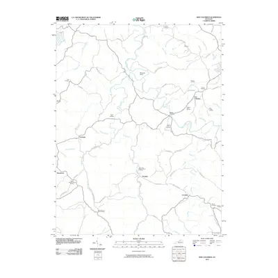
2010 Map of New Columbus
USGS Topo · Published 2010About this map
Eagle Creek meanders through this portion of Owen County, carving a path past the distinctive landform of Mountain Island and the small settlement of Natlee. This 2010 survey illustrates a rural Kentucky landscape where local history is preserved in a dense network of family and church burial grounds, such as the Hudson-Abbot Cemetery and True Cemetery. The map documents numerous creek-side communities including New Columbus, Rockdale, and Fairbanks, connected by a web of historic thoroughfares like Old Columbus Rd and Marshall Pike. The drainage patterns of Caney Creek and Lytles Fork define the valley floor, where institutions like the Caney Fork Baptist Church Cemetery served as central gathering points for the surrounding farmsteads. This topographical record is particularly valuable for genealogists tracing ancestral locations near the Old Beechwood Road Cemetery or the church at Beechwood.
Find a feature on this map
65 named features on this map. Tap any name to fly to it.
Don’t see what you’re looking for? This feature index may not catch every label — zoom into the map to look around manually.
Map Details
Editions of this 2010 New Columbus Map
This is the sole edition of this map. No revisions or reprints were ever made.
Other maps of this area

1906 · Lockport
USGS Topo · 1:48,000

1908 · Lockport
USGS Topo · 1:62,500

1939 · Sadieville
USGS Topo · 1:62,500

1950 · Mason
USGS Topo · 1:24,000

1950 · Owenton
USGS Topo · 1:24,000

1950 · Lawrenceville
USGS Topo · 1:24,000

1953 · Monterey
USGS Topo · 1:24,000

1953 · Sadieville
USGS Topo · 1:24,000
1953 · Stamping Ground
USGS Topo · 1:24,000
1953 · New Columbus
USGS Topo · 1:24,000