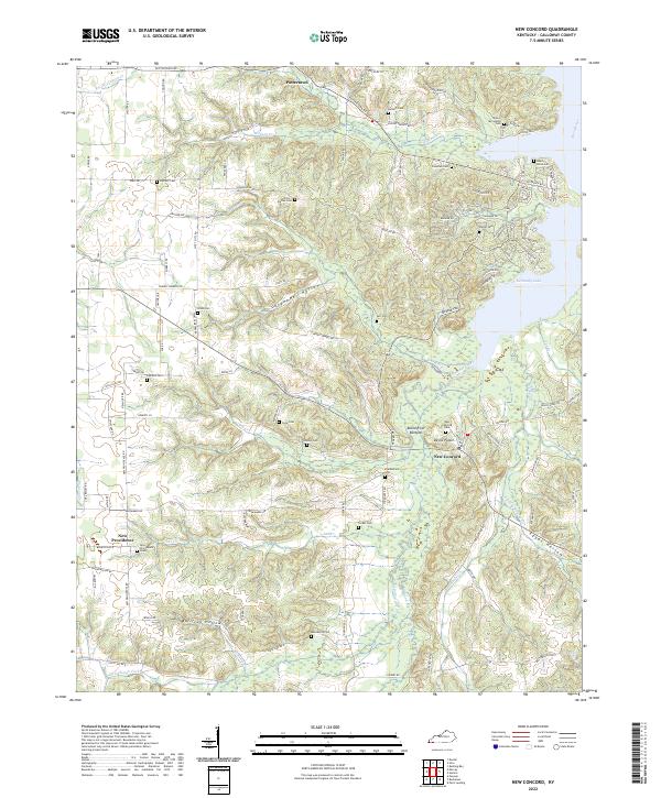
2022 Map of New Concord
USGS Topo · Published 2022About this map
Kentucky Lake and the meandering Blood River define the eastern boundary of this Calloway County landscape, where the Blood River Bottoms give way to a deeply dissected upland of hollows and ridges. Small, long-standing settlements like New Concord and Pottertown anchor a network of rural roads that follow the high ground between drainages like Panther Creek and Wildcat Cr. The area is notably dense with family burial grounds, including the John C McCuiston Cem and Fitts Dalton Cem, suggesting a long history of kinship-based land tenure. Moving south toward the state line, the terrain becomes increasingly complex around Egypt Hollow and Bullfrog Hollow, while the western edge of the sheet transitions toward the community of New Providence. The map captures a traditional rural Kentucky pattern where life and travel are dictated by the underlying limestone-carved topography.
Find a feature on this map
111 named features on this map. Tap any name to fly to it.
Don’t see what you’re looking for? This feature index may not catch every label — zoom into the map to look around manually.
Map Details
Editions of this 2022 New Concord Map
This is the sole edition of this map. No revisions or reprints were ever made.
Other maps of this area

1936 · Conyersville
USGS Topo · 1:24,000

1936 · Buchanan
USGS Topo · 1:24,000

1936 · Hazel
USGS Topo · 1:24,000

1936 · New Concord
USGS Topo · 1:24,000

1936 · Hamlin
USGS Topo · 1:24,000

1936 · Centerville Landing
USGS Topo · 1:24,000

1936 · Rushing
USGS Topo · 1:24,000

1936 · Dexter
USGS Topo · 1:24,000

1936 · Hico
USGS Topo · 1:24,000

1942 · New Concord
USGS Topo · 1:24,000