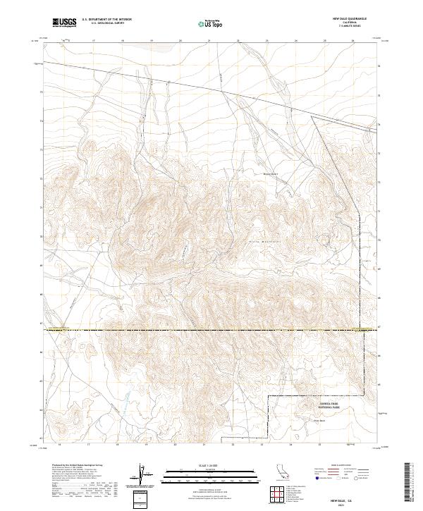
2021 Map of New Dale
USGS Topo · Published 2021About this map
The Pinto Mountains dominate this arid landscape where the Mojave Desert meets the northern boundary of Joshua Tree National Park. This territory, situated along the border of San Bernardino and Riverside counties, is defined by its industrial access routes and natural drainage systems. Several named roads, including Ironage Rd, Gold Crown Rd, and the Ivanhoe Mine Rd, cut through the high desert terrain, signifying the area's history of mineral exploration and transit. To the south, the terrain descends toward the Pinto Basin, where the San Bernardino Wash serves as a primary hydrological feature. The map provides a clear look at the township and range survey lines, such as t1s r12e and t1s r13e, which organize this vast expanse of public and park lands.
Find a feature on this map
16 named features on this map. Tap any name to fly to it.
Don’t see what you’re looking for? This feature index may not catch every label — zoom into the map to look around manually.
Map Details
Editions of this 2021 New Dale Map
This is the sole edition of this map. No revisions or reprints were ever made.
Other maps of this area

1942 · Amboy
USGS Topo · 1:250,000

1943 · Amboy
USGS Topo · 1:250,000

1943 · Pinkham Well
USGS Topo · 1:62,500

1944 · Pinkham Well
USGS Topo · 1:62,500

1944 · Eagle Tank
USGS Topo · 1:62,500

1954 · Salton Sea
USGS Topo · 1:250,000

1954 · Needles
USGS Topo · 1:250,000

1955 · Salton Sea
USGS Topo · 1:250,000

1956 · Needles
USGS Topo · 1:250,000

1956 · Dale Lake
USGS Topo · 1:62,500