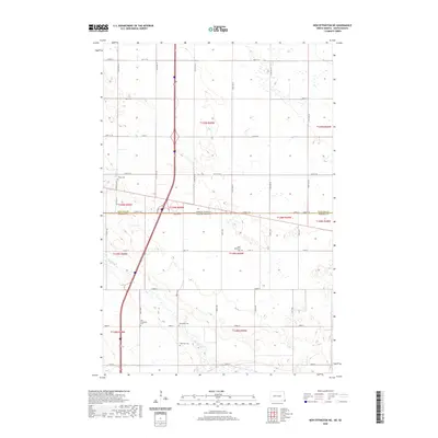
2020 Map of New Effington NE
USGS Topo · Published 2020About this map
The North Dakota and South Dakota state line cuts through this section of the Northern Plains, marking the transition between Richland County and Roberts County. The landscape is defined by the wandering path of the Big Slough, which meanders through the southern half of the quadrangle. This area serves as a significant intersection of early pioneer heritage, preserved through numerous rural burial grounds that dot the section lines. Genealogists will find a concentrated cluster of historic sites including Tyson Cem, Saint Nicholaus Cem, and Lakeview Cem. The presence of both the Old Brandvold Cem and the newer Brandvold Cem suggests a shifting community focus over time. The geometric precision of the township and range system is evident in the grid of local roads like Co Rd 22 and 101st St, which navigated the low-lying wetlands of the prairie.
Find a feature on this map
38 named features on this map. Tap any name to fly to it.
Don’t see what you’re looking for? This feature index may not catch every label — zoom into the map to look around manually.
Map Details
Editions of this 2020 New Effington NE Map
This is the sole edition of this map. No revisions or reprints were ever made.
Other maps of this area

1904 · Wahpeton
USGS Topo · 1:125,000

1915 · White Rock
USGS Topo · 1:62,500

1917 · New Effington
USGS Topo · 1:62,500

1918 · White Rock
USGS Topo · 1:62,500

1953 · Milbank
USGS Topo · 1:250,000

1953 · Fargo
USGS Topo · 1:250,000

1956 · Fargo
USGS Topo · 1:250,000

1958 · Milbank
USGS Topo · 1:250,000

1964 · Hankinson
USGS Topo · 1:24,000

1964 · Hankinson SE
USGS Topo · 1:24,000
Featured Places
- Lake Traverse District, SD
- Greendale Township, ND
- Heipa District
- LaMars Township, ND
- Richland County, ND