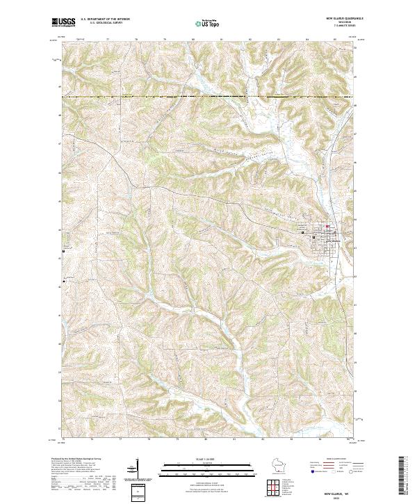
2022 Map of New Glarus
USGS Topo · Published 2022About this map
New Glarus anchors this portion of the Wisconsin landscape, situated where the Little Sugar River winds through a series of prominent drainages. The area is defined by a succession of named valleys, including Hustad Valley, Krieg Valley, and Pioneer Valley, which dictate the placement of the rural road network. Local heritage is preserved in several burial grounds such as Greens Prairie Cem and Postville Cem, along with the Swiss Reformed Cem located within the village. The drainage pattern is complex, with Hefty Cr and its tributaries like Center Br Hefty Cr carving through the terrain alongside the Legler School Br. This modern survey illustrates how traditional farm-to-market roads, such as Co HWY A and Co HWY O, continue to follow the natural contours of the land, while the Sugar River State Trl repurposes older transportation corridors for modern use.
Find a feature on this map
80 named features on this map. Tap any name to fly to it.
Don’t see what you’re looking for? This feature index may not catch every label — zoom into the map to look around manually.
Map Details
Editions of this 2022 New Glarus Map
This is the sole edition of this map. No revisions or reprints were ever made.
Historical Maps of Dane County Through Time
4 maps found