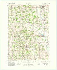
1962 Map of New Glarus
USGS Topo · Published 1980About this map
New Glarus serves as the focal point for this early 1960s study of southern Wisconsin, situated where the Little Sugar River begins its winding course southward. The landscape is defined by a dense network of dairy-land valleys, including Krieg Valley Creek and Durest Valley, alongside numerous limestone quarries that dot the hillsides near Mt Vernon and Belleville. The era's transportation infrastructure is preserved in detail, featuring the Illinois Central Railroad and the Chicago Milwaukee St Paul and Pacific Railroad carving through the glaciated terrain.
Find a feature on this map
74 named features on this map. Tap any name to fly to it.
Don’t see what you’re looking for? This feature index may not catch every label — zoom into the map to look around manually.
Map Details
Editions of this 1962 New Glarus Map
2 editions found
Other maps of this area

1889 · Evansville
USGS Topo · 1:62,500

1890 · Madison
USGS Topo · 1:62,500

1892 · Madison
USGS Topo · 1:62,500

1893 · Brodhead
USGS Topo · 1:62,500

1894 · Evansville
USGS Topo · 1:62,500

1904 · Madison
USGS Topo · 1:62,500

1906 · Evansville
USGS Topo · 1:62,500

1906 · Madison
USGS Topo · 1:62,500

1907 · Cross Plains
USGS Topo · 1:62,500

1909 · Cross Plains
USGS Topo · 1:62,500