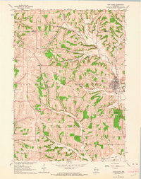
1962 Map of New Glarus
USGS Topo · Published 1964About this map
New Glarus serves as the focal point of this early 1960s survey, illustrating the concentrated development of the village alongside the Little Sugar River. The surrounding landscape is defined by a series of narrow drainage valleys, including Pioneer Valley and Durest Valley, which break the upland terrain. Numerous quarries dot the hillsides, suggesting a local economy tied to the land's geology even as the area maintains its agricultural character.
Find a feature on this map
29 named features on this map. Tap any name to fly to it.
Don’t see what you’re looking for? This feature index may not catch every label — zoom into the map to look around manually.
Map Details
Editions of this 1962 New Glarus Map
This is the sole edition of this map. No revisions or reprints were ever made.
Other maps of this area

1920 · Monroe
USGS Topo · 1:62,500

1922 · Monroe
USGS Topo · 1:62,500

1923 · Blanchardville
USGS Topo · 1:62,500

1923 · New Glarus
USGS Topo · 1:62,500

1923 · South Wayne
USGS Topo · 1:62,500

1954 · Rockford
USGS Topo · 1:250,000

1955 · Rockford
USGS Topo · 1:250,000

1958 · Rockford
USGS Topo · 1:250,000
1962 · New Glarus
USGS Topo · 1:62,500
1962 · Monroe NW
USGS Topo · 1:24,000