
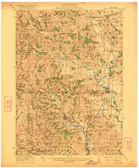
1923 Map of New Glarus
USGS Topo · Published 1923About this map
New Glarus sits at the heart of this survey of the northern Green County and southern Dane County line, reflecting a landscape defined by Swiss settlement patterns and the meandering courses of the Sugar River and its western branches. The rural character of the early 1920s is evident in the dense network of one-room schoolhouses, such as Spring Valley School and Farmers Grove School, which served the scattered farming communities. Significant early infrastructure includes the Illinois Central Railroad passing through Belleville and the Chicago and Northwestern Ry running through Verona at the northern edge. Natural landmarks like Devils Chimney and Picture Rock break the agricultural terrain, while social centers are marked by the Town Hall in Springdale and the County Farm near the rail line. The map captures an era when local life was anchored by these small neighborhood schools and the steady expansion of the State Trunk Highway No 19.
Find a feature on this map
69 named features on this map. Tap any name to fly to it.
Don’t see what you’re looking for? This feature index may not catch every label — zoom into the map to look around manually.
Map Details
Editions of this 1923 New Glarus Map
2 editions found
Other maps of this area

1889 · Evansville
USGS Topo · 1:62,500

1890 · Madison
USGS Topo · 1:62,500

1892 · Madison
USGS Topo · 1:62,500

1893 · Brodhead
USGS Topo · 1:62,500

1894 · Evansville
USGS Topo · 1:62,500

1904 · Madison
USGS Topo · 1:62,500

1906 · Evansville
USGS Topo · 1:62,500

1906 · Madison
USGS Topo · 1:62,500

1907 · Cross Plains
USGS Topo · 1:62,500

1909 · Cross Plains
USGS Topo · 1:62,500