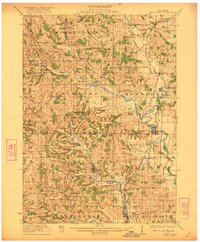
1923 Map of New Glarus
USGS Topo · Published 1923About this map
New Glarus and the surrounding townships of Springdale, Verona, and Montrose are documented here during a period of established agricultural and rail development. The map details a landscape deeply connected by the Sugar River and its branches, which dictated the placement of early settlements and transport lines. Two major railroads, the Illinois Central and the Chicago and Northwestern, intersect the region, serving as the economic lifelines for villages like Belleville, Paoli, and Basco.
Find a feature on this map
66 named features on this map. Tap any name to fly to it.
Don’t see what you’re looking for? This feature index may not catch every label — zoom into the map to look around manually.
Map Details
Editions of this 1923 New Glarus Map
2 editions found

Other maps of this area

1889 · Evansville
USGS Topo · 1:62,500

1890 · Madison
USGS Topo · 1:62,500

1892 · Madison
USGS Topo · 1:62,500

1893 · Brodhead
USGS Topo · 1:62,500

1894 · Evansville
USGS Topo · 1:62,500

1904 · Madison
USGS Topo · 1:62,500

1906 · Evansville
USGS Topo · 1:62,500

1906 · Madison
USGS Topo · 1:62,500

1907 · Cross Plains
USGS Topo · 1:62,500

1909 · Cross Plains
USGS Topo · 1:62,500