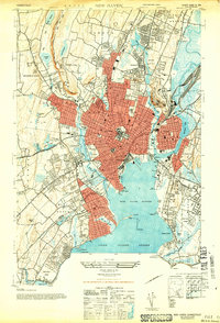
1943 Map of New Haven
USGS Topo · Published 1947About this map
New Haven radiates from its harbor toward the surrounding ridges in this 1943 survey, revealing the city's dense urban core and industrial waterfront during the height of the Second World War. The landscape is defined by the sharp transition from the bustling streets of Fair Haven and Westville to the prominent heights of West Rock Ridge. Along the coast, the recreational and maritime character of the era is evident at Savin Rock and the Sandy Point Lighthouse, while inland, the transport network is anchored by the extensive New York New Haven and Hartford rail lines. Significant local heritage is preserved in the cluster of burial grounds near the West River, including St Lawrence Cemetery and Evergreen Cemetery. The map captures a moment when early parkways like the Baldwin Parkway and Wilbur Cross Parkway were beginning to shape modern regional travel.
Find a feature on this map
75 named features on this map. Tap any name to fly to it.
Don’t see what you’re looking for? This feature index may not catch every label — zoom into the map to look around manually.
Map Details
Editions of this 1943 New Haven Map
2 editions found
Other maps of this area

1889 · Derby
USGS Topo · 1:62,500

1891 · Bridgeport
USGS Topo · 1:62,500

1891 · Derby
USGS Topo · 1:62,500

1892 · New Haven
USGS Topo · 1:62,500

1893 · Bridgeport
USGS Topo · 1:62,500

1893 · Derby
USGS Topo · 1:62,500

1920 · Bridgeport
USGS Topo · 1:62,500

1921 · New Haven
USGS Topo · 1:62,500

1943 · New Haven
USGS Topo · 1:31,680

1943 · Naugatuck
USGS Topo · 1:31,680