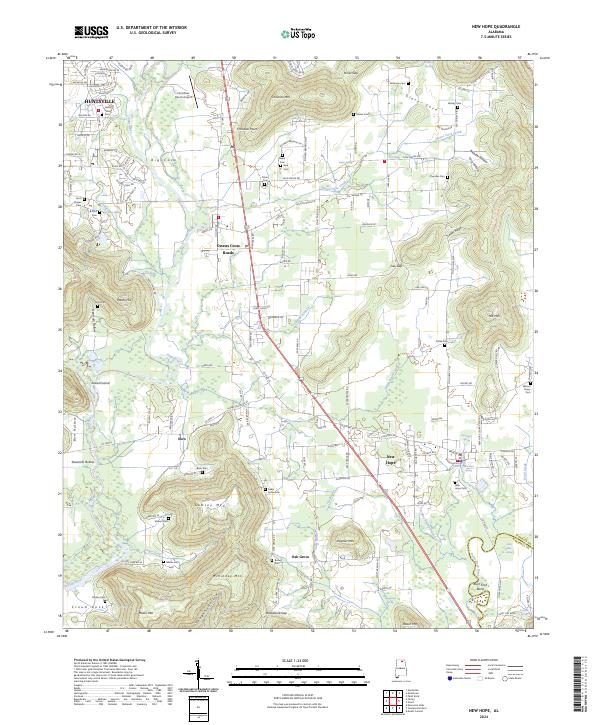
2024 Map of New Hope
USGS Topo · Published 2024About this map
New Hope and Owens Cross Roads serve as the primary hubs in this modern-day Madison County landscape, where the Paint Rock River and Flint River dictate the patterns of human settlement and transport. The area is defined by a dense network of family-named gaps and hollows, such as Hines Gap and Honea Hollow, which channel local roads between prominent peaks like Christian Mtn and Lemley Mtn. Genealogists will find a significant density of small burial grounds throughout the terrain, including Bush Cem, Drake Cem, and Byrd Cem, many of which remain tucked into the timbered slopes away from the main thoroughfares. Near the confluence of waterways, distinctive river features such as Shirt Tail Bend and Buck Ford Bend illustrate the historical importance of the river bends for navigation and local nomenclature. The presence of the Flint River Ranch Airport and the sprawling residential developments near Huntsville at the northwestern edge highlight the ongoing suburban evolution of this traditional agricultural and mountain valley region.
Find a feature on this map
151 named features on this map. Tap any name to fly to it.
Don’t see what you’re looking for? This feature index may not catch every label — zoom into the map to look around manually.
Map Details
Editions of this 2024 New Hope Map
This is the sole edition of this map. No revisions or reprints were ever made.
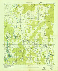
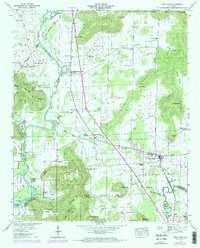
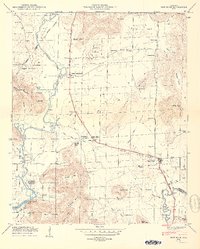
Historical Maps of Owens Cross Roads Through Time
4 maps found