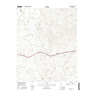
2016 Map of New Middleton
USGS Topo · Published 2016About this map
The rolling landscape of central Tennessee is meticulously detailed in this survey of Shaver Town and New Middleton. The area is defined by the convergence of several waterways, most notably Round Lick Creek and its tributaries like Jennings Fork and Dry Fork Cr. This 2016 edition provides a modern view of established rural communities, showing the persisting footprint of local heritage through numerous family-named landmarks and burial sites. Genealogists will find a wealth of data points, including Bethlehem Cem, Shaver Cem, and Commerce Cem, which anchor the small settlements of Grant and Commerce. The terrain is marked by distinct summits such as Evans Mtn, Blue Knob, and Pilot Knob, illustrating the elevation changes that have historically influenced road placement and land use across the Smith and Wilson County line.
Find a feature on this map
106 named features on this map. Tap any name to fly to it.
Don’t see what you’re looking for? This feature index may not catch every label — zoom into the map to look around manually.
Map Details
Editions of this 2016 New Middleton Map
This is the sole edition of this map. No revisions or reprints were ever made.
Other maps of this area

1928 · Gordonsville
USGS Topo · 1:62,500

1932 · Carthage
USGS Topo · 1:62,500

1942 · Statesville
USGS Topo · 1:100,000

1956 · Corbin
USGS Topo · 1:250,000

1956 · Nashville
USGS Topo · 1:250,000

1958 · New Middleton
USGS Topo · 1:24,000

1958 · Corbin
USGS Topo · 1:250,000

1958 · Bellwood
USGS Topo · 1:24,000

1958 · Watertown
USGS Topo · 1:24,000

1958 · Dixon Springs
USGS Topo · 1:24,000