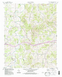
1994 Map of New Middleton
USGS Topo · Published 1997About this map
Round Lick Creek and its many tributaries, including Jennings Fork and Mulherrin Creek, dominate this section of the Tennessee interior. The landscape is defined by its rural settlements and religious centers, such as New Middleton and Grant, alongside numerous country churches like Rawls Creek Ch and Cumberland Ch. The terrain is punctuated by significant rises, including Belle Hill and Tomahawk Knob, which overlook a network of valley roads and small family cemeteries.
Find a feature on this map
53 named features on this map. Tap any name to fly to it.
Don’t see what you’re looking for? This feature index may not catch every label — zoom into the map to look around manually.
Map Details
Editions of this 1994 New Middleton Map
This is the sole edition of this map. No revisions or reprints were ever made.
Other maps of this area

1928 · Gordonsville
USGS Topo · 1:62,500

1932 · Carthage
USGS Topo · 1:62,500

1942 · Statesville
USGS Topo · 1:100,000

1956 · Corbin
USGS Topo · 1:250,000

1956 · Nashville
USGS Topo · 1:250,000

1958 · New Middleton
USGS Topo · 1:24,000

1958 · Corbin
USGS Topo · 1:250,000

1958 · Bellwood
USGS Topo · 1:24,000

1958 · Watertown
USGS Topo · 1:24,000

1958 · Dixon Springs
USGS Topo · 1:24,000