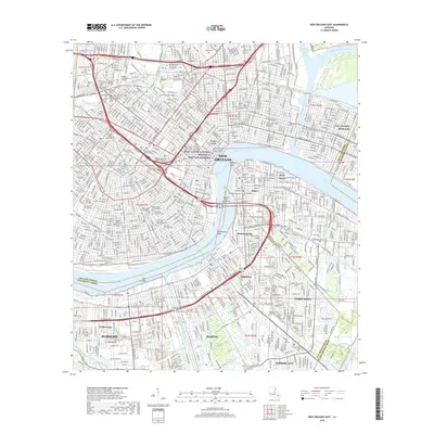
2018 Map of New Orleans East
USGS Topo · Published 2018About this map
The Mississippi River carves a sharp path through this urban landscape, winding around Gouldsboro Bend and separating the historic Vieux Carre and Central Business District from the West Bank communities of Algiers Point and McDonoghville. This map captures a densely layered metropolitan environment, where historic burial grounds like Metairie Cem, Saint Louis Cem Number 1, and Greenwood Cem stand alongside modern academic institutions such as Dillard Univ and Xavier Univ of Louisiana. The industrial and maritime character of the region is evident in the complex network of waterways, including the Inner Harbor Navigation Canal and the industrial infrastructure of the Harvey Canal Number One. South of the river, the suburban growth of Terrytown and Marrero contrasts with the preserved areas of the Jean Lafitte National Historical Park and Preserve, while NG Jackson Barracks anchors the eastern edge of the city.
Find a feature on this map
125 named features on this map. Tap any name to fly to it.
Don’t see what you’re looking for? This feature index may not catch every label — zoom into the map to look around manually.
Map Details
Editions of this 2018 New Orleans East Map
This is the sole edition of this map. No revisions or reprints were ever made.
Other maps of this area

1891 · Spanish Fort
USGS Topo · 1:62,500

1891 · New Orleans
USGS Topo · 1:62,500

1892 · Chef Menteur
USGS Topo · 1:62,500

1892 · St. Bernard
USGS Topo · 1:62,500

1932 · New Orleans NE
USGS Topo · 1:31,680

1932 · New Orleans NW
USGS Topo · 1:31,680

1932 · New Orleans SE
USGS Topo · 1:31,680

1932 · New Orleans SW
USGS Topo · 1:31,680

1936 · Chef Menteur
USGS Topo · 1:62,500

1936 · Spanish Fort
USGS Topo · 1:62,500