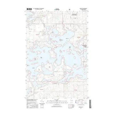
2015 Map of New Post
USGS Topo · Published 2015About this map
The community of New Post sits at the southern edge of the massive Lake Chippewa impoundment, a landscape defined by an intricate network of bays, islands, and narrows. This 2015 survey reveals the complex shoreline of the Chippewa Flowage, featuring numerous named points and islands such as Slivers Point, Darrow Island, and Scott Island. To the north and east, the Chequamegon National Forest provides a buffer of protected woodland, sheltering smaller water bodies like Callahan Lake and the Fork Chief River. The southern half of the map transitions into more settled areas with a dense grid of local roads like Chippewa Flowage Rd and Resvn Hwy 4, alongside smaller lakes including Blueberry Lake and Two Boys Lake. The map serves as a contemporary record of this Northwoods recreation and residential hub, tracing the many inlets from Milwaukee Bay to the Cranberry Narrows.
Find a feature on this map
88 named features on this map. Tap any name to fly to it.
Don’t see what you’re looking for? This feature index may not catch every label — zoom into the map to look around manually.
Map Details
Editions of this 2015 New Post Map
This is the sole edition of this map. No revisions or reprints were ever made.
Other maps of this area

1943 · Namekagon Lake
USGS Topo · 1:48,000

1944 · Couderay
USGS Topo · 1:48,000

1944 · Radisson
USGS Topo · 1:48,000

1944 · Hayward
USGS Topo · 1:48,000

1945 · Namekagon Lake
USGS Topo · 1:48,000

1948 · Couderay
USGS Topo · 1:48,000

1949 · Radisson
USGS Topo · 1:48,000

1953 · Ashland
USGS Topo · 1:250,000

1953 · Rice Lake
USGS Topo · 1:250,000

1958 · Ashland
USGS Topo · 1:250,000