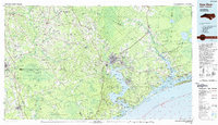
1991 Map of New River
USGS Topo · Published 1991About this map
Jacksonville sits at the head of the New River, serving as the primary hub for the Camp Lejeune Military Reservation and the surrounding coastal plains. This 1991 edition captures the intricate geography of the Onslow County shoreline, where the White Oak River meets the Bogue Sound near Swansboro. The landscape is defined by its vast pocosin and swamp systems, including the Angola Swamp and the Great Sandy Run Pocosin, which illustrate the natural barriers that shaped early settlement patterns.
Find a feature on this map
124 named features on this map. Tap any name to fly to it.
Don’t see what you’re looking for? This feature index may not catch every label — zoom into the map to look around manually.
Map Details
Editions of this 1991 New River Map
This is the sole edition of this map. No revisions or reprints were ever made.
Other maps of this area

1901 · New Bern
USGS Topo · 1:62,500

1903 · New Bern
USGS Topo · 1:62,500

1903 · Trent River
USGS Topo · 1:62,500

1904 · Trent River
USGS Topo · 1:62,500

1942 · Spicer Bay
USGS Topo · 1:62,500

1942 · Topsail
USGS Topo · 1:62,500

1942 · Burgaw
USGS Topo · 1:62,500

1942 · Maysville
USGS Topo · 1:62,500

1942 · Swansboro
USGS Topo · 1:62,500

1943 · Jacksonville
USGS Topo · 1:62,500