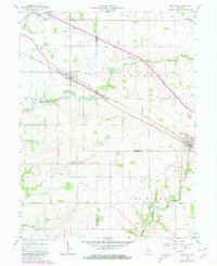
1957 Map of New Ross
USGS Topo · Published 1980About this map
New Ross sits at the intersection of railway and creek in this mid-century survey of the Indiana countryside, where the Conrail line parallels the winding course of Big Raccoon Creek. The landscape is a study in rural organization, defined by the meeting of Montgomery, Boone, and Hendricks counties. Smaller agricultural hubs like Advance and Jamestown anchor the eastern edges of the sheet, connected by a network of farm-to-market roads and high-pressure Pipeline corridors. Genealogists will find a high density of small family and community burial grounds, including Wesley Cem, Porter Cem, and Mt Pleasant Cem, often located at the margins of large farm tracts. The presence of specialized structures like Storage Bins at the rail siding and the Advance Conservation Club suggests a community centered on grain production and local recreation during the late 1950s.
Find a feature on this map
26 named features on this map. Tap any name to fly to it.
Don’t see what you’re looking for? This feature index may not catch every label — zoom into the map to look around manually.
Map Details
Editions of this 1957 New Ross Map
Other maps of this area

1953 · Lizton
USGS Topo · 1:24,000

1953 · Danville
USGS Topo · 1:24,000

1953 · Danville
USGS Topo · 1:250,000

1953 · Indianapolis
USGS Topo · 1:250,000

1955 · Danville
USGS Topo · 1:250,000

1956 · Danville
USGS Topo · 1:250,000

1956 · Indianapolis
USGS Topo · 1:250,000

1957 · Indianapolis
USGS Topo · 1:250,000

1957 · New Ross
USGS Topo · 1:24,000

1958 · Darlington
USGS Topo · 1:24,000