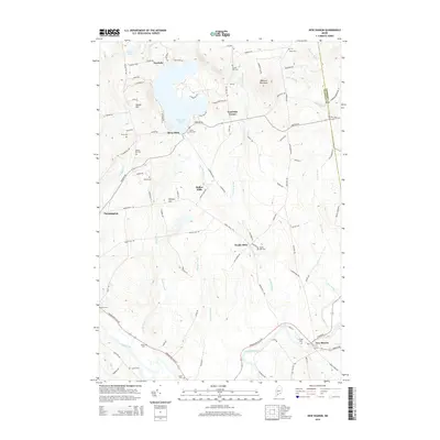
2014 Map of New Sharon
USGS Topo · Published 2014About this map
The Sandy River winds through the southern portion of this landscape, anchoring the village of New Sharon where Main St meets the water. The terrain is defined by a network of historic mill settlements and family-named landmarks that reflect centuries of rural Maine industry. Northward, the waters of Clearwater Pond are flanked by Overlake and Allens Mills, while the interior is marked by significant elevations like Mosher Hill and Bannock Mountain.
Find a feature on this map
71 named features on this map. Tap any name to fly to it.
Don’t see what you’re looking for? This feature index may not catch every label — zoom into the map to look around manually.
Map Details
Editions of this 2014 New Sharon Map
This is the sole edition of this map. No revisions or reprints were ever made.
Other maps of this area

1894 · Norridgewock
USGS Topo · 1:62,500

1898 · Norridgewock
USGS Topo · 1:62,500

1904 · Anson
USGS Topo · 1:62,500

1924 · Farmington
USGS Topo · 1:62,500

1930 · Kingfield
USGS Topo · 1:48,000

1932 · Kingfield
USGS Topo · 1:62,500

1943 · Norridgewock
USGS Topo · 1:62,500

1948 · Bangor
USGS Topo · 1:250,000

1950 · Lewiston
USGS Topo · 1:250,000

1955 · Anson
USGS Topo · 1:62,500