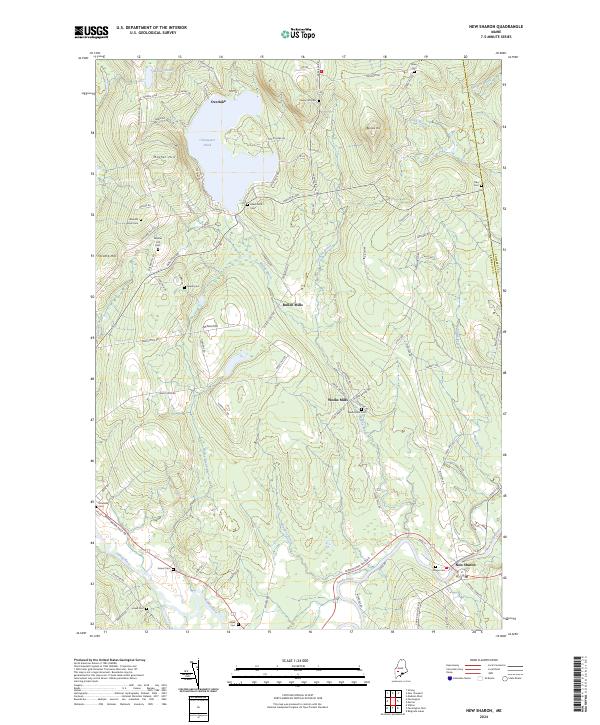
2024 Map of New Sharon
USGS Topo · Published 2024About this map
The Sandy River winds through the southeastern corner of this New England landscape, where the village of New Sharon serves as a local hub. The geography is defined by a network of hills and water bodies, including Clearwater Pond and Mosher Pond in the north, surrounded by numerous family-named landmarks. The map reveals a high density of small burial grounds that point to the area's deep genealogical roots, such as the Allens Mills Cem and Weeks Mills Cem.
Find a feature on this map
87 named features on this map. Tap any name to fly to it.
Don’t see what you’re looking for? This feature index may not catch every label — zoom into the map to look around manually.
Map Details
Editions of this 2024 New Sharon Map
This is the sole edition of this map. No revisions or reprints were ever made.
Other maps of this area

1894 · Norridgewock
USGS Topo · 1:62,500

1898 · Norridgewock
USGS Topo · 1:62,500

1904 · Anson
USGS Topo · 1:62,500

1924 · Farmington
USGS Topo · 1:62,500

1930 · Kingfield
USGS Topo · 1:48,000

1932 · Kingfield
USGS Topo · 1:62,500

1943 · Norridgewock
USGS Topo · 1:62,500

1948 · Bangor
USGS Topo · 1:250,000

1950 · Lewiston
USGS Topo · 1:250,000

1955 · Anson
USGS Topo · 1:62,500