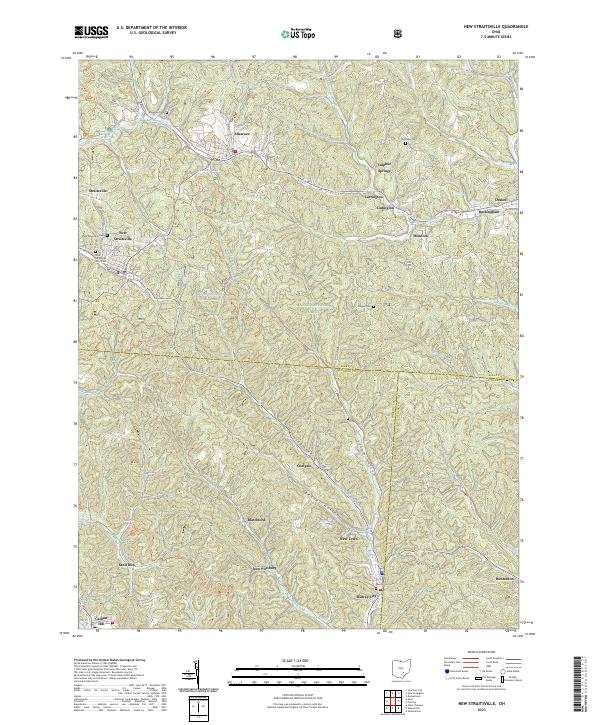
2023 Map of New Straitsville
USGS Topo · Published 2023About this map
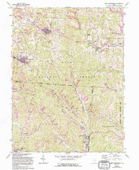
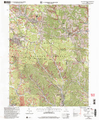
Shawnee and New Straitsville anchor this survey of the hill country where Perry, Hocking, and Athens counties meet. The landscape is defined by the steep ridges of Dugan Ridge and Taylor Ridge, with narrow hollows such as Sycamore Hollow and Spencer Hollow providing the primary routes for local development. Much of the area is contained within the Wayne National Forest, which includes the Wayne National Forest Pond and recreational features like the North Country National Scenic Trail.
Find a feature on this map
59 named features on this map. Tap any name to fly to it.
Don’t see what you’re looking for? This feature index may not catch every label — zoom into the map to look around manually.
Map Details
Editions of this 2023 New Straitsville Map
This is the sole edition of this map. No revisions or reprints were ever made.
Historical Maps of Jobs Through Time
3 maps found