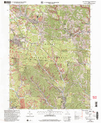
2002 Map of New Straitsville
USGS Topo · Published 2006About this map
New Straitsville and Shawnee anchor this detailed study of the Appalachian Plateau during the early 2000s, an area defined by its coal-mining legacy and the expansive Wayne National Forest. The landscape is etched with narrow hollows and high ridges like Dugan Ridge and Taylor Ridge, where small settlements such as Hemlock, Drakes, and Buckingham sit tucked along the winding courses of Sunday Creek and Monday Creek.
Find a feature on this map
49 named features on this map. Tap any name to fly to it.
Don’t see what you’re looking for? This feature index may not catch every label — zoom into the map to look around manually.
Map Details
Editions of this 2002 New Straitsville Map
This is the sole edition of this map. No revisions or reprints were ever made.
Other maps of this area

1903 · Athens
USGS Topo · 1:62,500

1904 · Zaleski
USGS Topo · 1:62,500

1905 · Athens
USGS Topo · 1:62,500

1907 · Zaleski
USGS Topo · 1:62,500

1907 · Logan
USGS Topo · 1:62,500

1909 · Logan
USGS Topo · 1:62,500

1911 · New Lexington
USGS Topo · 1:62,500

1947 · Columbus
USGS Topo · 1:250,000

1961 · Columbus
USGS Topo · 1:250,000

1961 · Nelsonville
USGS Topo · 1:24,000