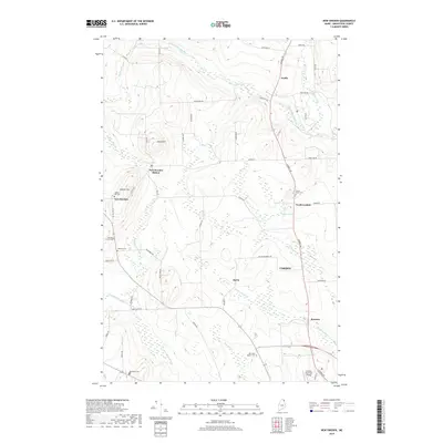
2018 Map of New Sweden
USGS Topo · Published 2018About this map
New Sweden and the surrounding Swedish-settled townships of Aroostook County are defined by a landscape of rolling hills and organized agricultural plots. The township structure is clearly visible through a grid of roads such as Jemtland Rd, Madawaska Rd, and Station Rd, reflecting the late 19th-century Swedish Colony established in the North Maine Woods. Smaller settlements like New Sweden Station, Acadia, and North Lyndon provide focal points for the rural community, while the presence of numerous small burial grounds, including Williams Family Cem and Capitol Hill Cem, offers significant research value for genealogists studying the area's early families. The terrain is marked by distinctive heights like Gelot Hill and Capitol Hill, with the Little Madawaska River and Caribou Stream draining the fertile highlands. To the south, the expansion of Caribou is signaled by the Caribou Municipal Airport and the modern cluster at Barretts.
Find a feature on this map
59 named features on this map. Tap any name to fly to it.
Don’t see what you’re looking for? This feature index may not catch every label — zoom into the map to look around manually.
Map Details
Editions of this 2018 New Sweden Map
This is the sole edition of this map. No revisions or reprints were ever made.
Other maps of this area

1921 · Van Buren
USGS Topo · 1:250,000

1927 · Stockholm
USGS Topo · 1:48,000

1929 · Caribou
USGS Topo · 1:48,000

1930 · Fort Fairfield
USGS Topo · 1:48,000

1931 · Van Buren
USGS Topo · 1:48,000

1931 · Stockholm
USGS Topo · 1:62,500

1932 · Caribou
USGS Topo · 1:62,500

1933 · Fort Fairfield
USGS Topo · 1:62,500

1934 · Van Buren
USGS Topo · 1:62,500

1951 · Van Buren
USGS Topo · 1:62,500