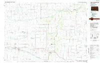
1984 Map of New Underwood
USGS Topo · Published 1984About this map
New Underwood and the surrounding plains of Pennington Co and Meade Co are defined by the convergence of the Belle Fourche River and the Cheyenne River. The landscape is a network of draws and flats, with agricultural life centered around small settlements like Elm Springs and Wasta. In the southern portion of the map, Interstate 90 and the Chicago and North Western railroad corridor provide the primary east-west transport link through Wicksville and Owanka. This 1984 survey highlights a region dedicated to conservation and land management, featuring large protected areas such as the New Underwood State Wildlife Management Area, Curlew Lake State Wildlife Management Area, and Tisdale Dam State Wildlife Management Area. The map captures the quiet transition of a ranching landscape between the river breaks and the high flats like Harwood Flat.
Find a feature on this map
64 named features on this map. Tap any name to fly to it.
Don’t see what you’re looking for? This feature index may not catch every label — zoom into the map to look around manually.
Map Details
Editions of this 1984 New Underwood Map
2 editions found
Other maps of this area

1893 · Rapid
USGS Topo · 1:125,000

1894 · Hermosa
USGS Topo · 1:125,000

1898 · Rapid
USGS Topo · 1:125,000

1901 · Hermosa
USGS Topo · 1:125,000

1903 · Rapid
USGS Topo · 1:125,000

1913 · Newell
USGS Topo · 1:125,000

1951 · Volunteer SE
USGS Topo · 1:24,000

1953 · Bend
USGS Topo · 1:24,000

1953 · Viewfield
USGS Topo · 1:24,000

1953 · Hereford SE
USGS Topo · 1:24,000