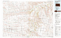
1984 Map of New Underwood
USGS Topo · Published 1989About this map
Cheyenne River and the Belle Fourche River carve a winding course through this West River landscape, defining the northern and eastern reaches of Pennington County in the early 1980s. The region is characterized by extensive ranchlands and small prairie settlements like New Underwood and Owanka, which sit along the path of the Chicago and North Western railroad. To the north, the terrain becomes increasingly dissected by numerous draws such as Maddox Draw and Haydraw Draw, while isolated hills like Cedar Butte and Lakeside rise above the surrounding flats. Local infrastructure includes the Hoffman Landing Strip and a significant powerline corridor that bisects the southern townships. Conservation efforts are evident in the management of water resources at the Curlew Lake State Wildlife Management Area and the Tisdale Dam State Wildlife Management Area, reflecting the area's focus on both agriculture and wildlife preservation.
Find a feature on this map
58 named features on this map. Tap any name to fly to it.
Don’t see what you’re looking for? This feature index may not catch every label — zoom into the map to look around manually.
Map Details
Editions of this 1984 New Underwood Map
2 editions found
Other maps of this area

1893 · Rapid
USGS Topo · 1:125,000

1894 · Hermosa
USGS Topo · 1:125,000

1898 · Rapid
USGS Topo · 1:125,000

1901 · Hermosa
USGS Topo · 1:125,000

1903 · Rapid
USGS Topo · 1:125,000

1913 · Newell
USGS Topo · 1:125,000

1951 · Volunteer SE
USGS Topo · 1:24,000

1953 · Bend
USGS Topo · 1:24,000

1953 · Viewfield
USGS Topo · 1:24,000

1953 · Hereford SE
USGS Topo · 1:24,000