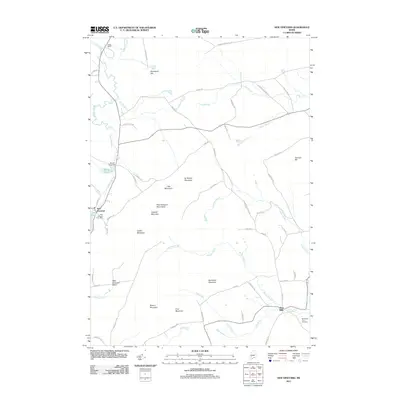
2011 Map of New Vineyard
USGS Topo · Published 2011About this map
New Vineyard and West Mills serve as the primary hubs in this section of Franklin County, where the landscape is defined by the New Vineyard Mountains and the persistent flow of Lemon Stream. The local economy and settlement patterns are closely tied to the water, as evidenced by the Bauds Pond Dam and the Mill Pond located near the village center. This area exhibits a typical Maine interior geography, with scattered family-named peaks such as Caswell Mountain, Griffin Mountain, and Norton Mountain surrounding the low-lying New Vineyard Basin. For genealogists and local historians, the Boardman-True Cemetery and the New Vineyard Post Office provide essential reference points for tracing early families and civic development. The network of brooks, including Luce Brook, Barker Brook, and Mitchell Brook, illustrates the intricate drainage system that historically supported the region's timber and agricultural interests.
Find a feature on this map
66 named features on this map. Tap any name to fly to it.
Don’t see what you’re looking for? This feature index may not catch every label — zoom into the map to look around manually.
Map Details
Editions of this 2011 New Vineyard Map
This is the sole edition of this map. No revisions or reprints were ever made.
Other maps of this area

1894 · Norridgewock
USGS Topo · 1:62,500

1898 · Norridgewock
USGS Topo · 1:62,500

1904 · Anson
USGS Topo · 1:62,500

1924 · Farmington
USGS Topo · 1:62,500

1930 · Kingfield
USGS Topo · 1:48,000

1932 · Kingfield
USGS Topo · 1:62,500

1943 · Norridgewock
USGS Topo · 1:62,500

1948 · Bangor
USGS Topo · 1:250,000

1950 · Lewiston
USGS Topo · 1:250,000

1955 · Anson
USGS Topo · 1:62,500