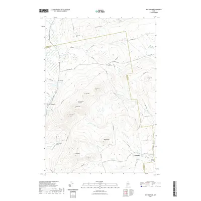
2021 Map of New Vineyard
USGS Topo · Published 2021About this map
New Vineyard and the outlying village of West Mills are the primary hubs of activity in this pocket of Maine. The landscape is dominated by the New Vineyard Mountains, a series of peaks including Griffin Mtn, Caswell Mtn, and Ick-Norton Mtn. This terrain dictates the path of the region's many waterways, such as Lemon Stream and Mitchell Brook, which flow through deep valleys and basins. For genealogists and local historians, the sheet is exceptionally detailed in its placement of family-named landmarks and rural burial grounds. Numerous small cemeteries like Carsley Cem, Pratt Corner Cem, and the Boardman True Cem are carefully noted, often situated near old road intersections like Talcott Corner Cem. The presence of Mill Pond near the center of town points to the historic water-powered industries that once supported these upland communities.
Find a feature on this map
70 named features on this map. Tap any name to fly to it.
Don’t see what you’re looking for? This feature index may not catch every label — zoom into the map to look around manually.
Map Details
Editions of this 2021 New Vineyard Map
This is the sole edition of this map. No revisions or reprints were ever made.
Other maps of this area

1894 · Norridgewock
USGS Topo · 1:62,500

1898 · Norridgewock
USGS Topo · 1:62,500

1904 · Anson
USGS Topo · 1:62,500

1924 · Farmington
USGS Topo · 1:62,500

1930 · Kingfield
USGS Topo · 1:48,000

1932 · Kingfield
USGS Topo · 1:62,500

1943 · Norridgewock
USGS Topo · 1:62,500

1948 · Bangor
USGS Topo · 1:250,000

1950 · Lewiston
USGS Topo · 1:250,000

1955 · Anson
USGS Topo · 1:62,500