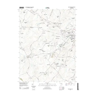
2014 Map of New Windsor
USGS Topo · Published 2014About this map
New Windsor and Uniontown serve as the primary anchors for this part of Carroll County, where the landscape is defined by the winding paths of Little Pipe Cr and Meadow Br Big Pipe Cr. The 2014 survey reveals a transition from these older, established centers to newer residential developments like Rockland Estates and Maring Manor. Genealogists and local historians will find an exceptional density of burial sites across the terrain, including Pipe Creek Cem, Baust Cem, and the Saint Benjamins Cem near the northeastern corner. The presence of New Windsor Town Hall and multiple named mills, such as Wakefield Mill and Wagners Mill, reflects a community that has long balanced municipal administration with a water-driven agricultural economy. Air travel is represented by both the Carroll County Regional Airport and the smaller Three J Airport to the west.
Find a feature on this map
196 named features on this map. Tap any name to fly to it.
Don’t see what you’re looking for? This feature index may not catch every label — zoom into the map to look around manually.
Map Details
Editions of this 2014 New Windsor Map
This is the sole edition of this map. No revisions or reprints were ever made.
Other maps of this area

1892 · Ellicott
USGS Topo · 1:62,500

1893 · Frederick
USGS Topo · 1:125,000

1894 · Ellicott
USGS Topo · 1:62,500

1894 · Frederick
USGS Topo · 1:125,000

1905 · Westminster
USGS Topo · 1:62,500

1906 · Ellicott
USGS Topo · 1:62,500

1908 · Patapsco
USGS Topo · 1:125,000

1909 · Mount Airy
USGS Topo · 1:62,500

1911 · Taneytown
USGS Topo · 1:62,500

1942 · Gettysburg
USGS Topo · 1:125,000
Featured Places
- Westminster, MD
- New Windsor, MD
- Tri-Woods, MD
- Whispering Meadows, Westminster
- Stevenson Garden Estates, MD