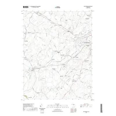
2019 Map of New Windsor
USGS Topo · Published 2019About this map
Westminster and its western suburbs anchor this region of central Maryland, where the landscape transitions from the residential developments of Blue Ridge View and Avondale into a sprawling agricultural hinterland. The map documents a persistent milling legacy along the waterways, featuring Roop Mill on Roop Br and both Wakefield Mill and Wagners Mill near the community of Wakefield. This rural layout is defined by numerous historic congregations and their associated burial grounds, including the New Windsor Presbyterian Church Cem and the Saint Pauls United Methodist Brick Chapel Cem. Aviation and agriculture intersect at Baugher's Orchard Airport, while the terrain rises toward Parrs Ridge in the southeast. Notable for genealogists, the map identifies small rural settlements like Tyrone, Frizzellburg, and Uniontown, each connected by a dense network of local roads such as Old Taneytown Rd.
Find a feature on this map
180 named features on this map. Tap any name to fly to it.
Don’t see what you’re looking for? This feature index may not catch every label — zoom into the map to look around manually.
Map Details
Editions of this 2019 New Windsor Map
This is the sole edition of this map. No revisions or reprints were ever made.
Other maps of this area

1892 · Ellicott
USGS Topo · 1:62,500

1893 · Frederick
USGS Topo · 1:125,000

1894 · Ellicott
USGS Topo · 1:62,500

1894 · Frederick
USGS Topo · 1:125,000

1905 · Westminster
USGS Topo · 1:62,500

1906 · Ellicott
USGS Topo · 1:62,500

1908 · Patapsco
USGS Topo · 1:125,000

1909 · Mount Airy
USGS Topo · 1:62,500

1911 · Taneytown
USGS Topo · 1:62,500

1942 · Gettysburg
USGS Topo · 1:125,000
Featured Places
- Westminster, MD
- New Windsor, MD
- Tri-Woods, MD
- Whispering Meadows, Westminster
- Stevenson Garden Estates, MD