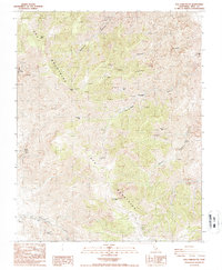
1987 Map of New York Butte
USGS Topo · Published 1987About this map
Inyo Mountains dominate this high-altitude landscape, where the extreme relief defined the limits of settlement and industry in the late 20th century. The settlement of Beveridge is the primary hub of activity in a region characterized by deep canyons and isolated summits like Mount Inyo and New York Butte. The area’s economic history is written in the многочисленные mining operations scattered across the steep slopes, including the Snow Flake Mine, Bighorn Mine, and Long John Mine.
Find a feature on this map
25 named features on this map. Tap any name to fly to it.
Don’t see what you’re looking for? This feature index may not catch every label — zoom into the map to look around manually.
Map Details
Editions of this 1987 New York Butte Map
This is the sole edition of this map. No revisions or reprints were ever made.
Other maps of this area

1907 · Mt. Whitney
USGS Topo · 1:125,000

1908 · Ballarat
USGS Topo · 1:250,000

1913 · Ballarat
USGS Topo · 1:250,000

1919 · Mt. Whitney
USGS Topo · 1:125,000

1937 · Mt. Whitney
USGS Topo · 1:125,000

1948 · Death Valley
USGS Topo · 1:250,000

1948 · Fresno
USGS Topo · 1:250,000

1950 · New York Butte
USGS Topo · 1:62,500

1951 · New York Butte
USGS Topo · 1:62,500

1951 · Waucoba Wash
USGS Topo · 1:62,500