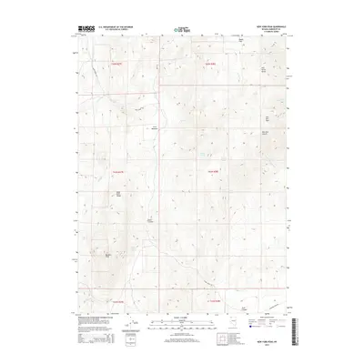
2015 Map of New York Peak
USGS Topo · Published 2015About this map
New York Peak and Bartlett Peak define the high ridgelines of this Humboldt County terrain, where the Pine Forest Range and Black Rock Range converge. This 2015 survey documents a landscape shaped by water sources essential to the region's ranching and mining history, including Lone Meadow Spring, Willow Spring, and Josie Pearl Spring. The presence of Cove Meadows and Rodeo Flat suggests the historical use of these uplands for livestock, while the named canyons like Pearl Canyon and New York Canyon follow the drainage of seasonal creeks such as Craine Cr and Corral Cr. Primitive access is maintained via Pearl Creek Rd and Leonard Creek Rd, providing a detailed look at the geographical relationship between these peaks and the surrounding Great Basin desert high country.
Find a feature on this map
30 named features on this map. Tap any name to fly to it.
Don’t see what you’re looking for? This feature index may not catch every label — zoom into the map to look around manually.
Map Details
Editions of this 2015 New York Peak Map
This is the sole edition of this map. No revisions or reprints were ever made.
Other maps of this area

1886 · Disaster
USGS Topo · 1:250,000

1893 · Disaster
USGS Topo · 1:250,000

1954 · Vya
USGS Topo · 1:250,000

1958 · Vya
USGS Topo · 1:250,000

1962 · Vya
USGS Topo · 1:250,000

1965 · Idaho Canyon
USGS Topo · 1:62,500

1965 · Duffer Peak
USGS Topo · 1:62,500

1972 · Burnt Springs
USGS Topo · 1:24,000

1972 · Leonard Cr. Slough North
USGS Topo · 1:24,000
1972 · Battle Creek Ranch
USGS Topo · 1:24,000